Archive for Canyonlands National Park

Day 4 – Capitol Reef, Canyonlands

Posted in Photography, Travel with tags , , , , on 14 October 2013 by Richard Hornbaker

[This post is part of The Accidental Photo Adventure]

Capitol Reef National Park

After a light breakfast in the motel lobby, we’re back on the road.  Capitol Reef kept coming up as a notable place to visit, so we mapped a route through it on the way to Canyonlands.  It’d only cost us about 90 minutes, plus we’d started to wonder how many national parks we could hit in one road trip.

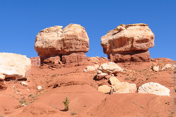
Near the entrance, it wasn’t obvious how Capitol Reef got its name, but we were fascinated by the contrast in rocks.  A deep red base topped by very white boulders.

DDD_2369

DDD_2366

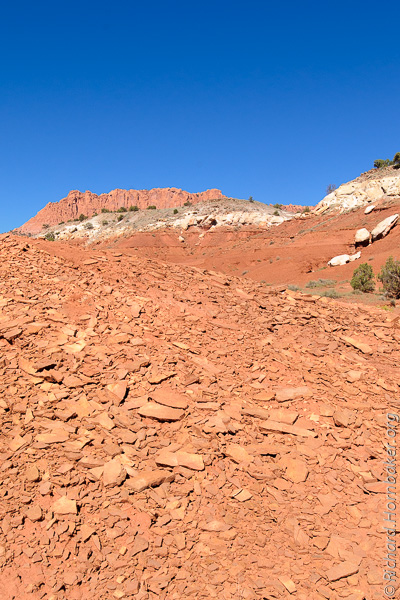
The red soil was odd, like slate or shale – thin, brittle layers:

DDD_2368

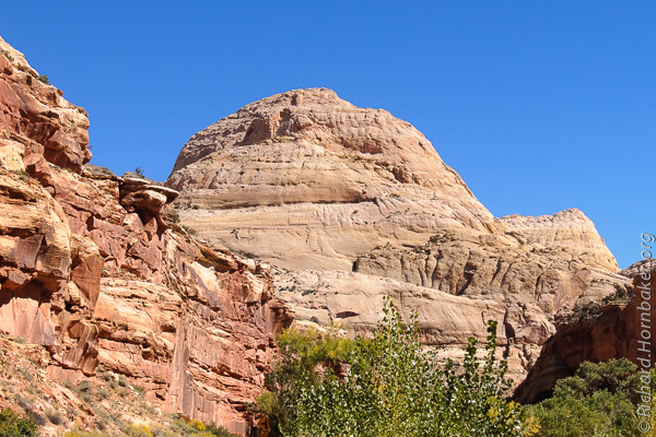
Past the visitor’s center, the scene starts to explain the name – here’s Capitol Rock:

DDD_2558

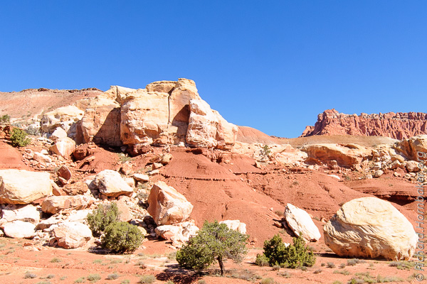
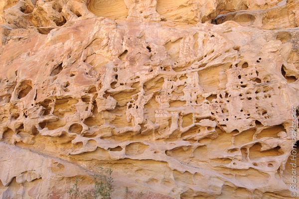
A bit further, and the “Reef” part of the name starts to make sense – the canyon walls look like Swiss cheese.

DDD_2561

DDD_2567

DDD_2574

Canyonlands National Park

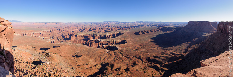
We reached Canyonlands later in the day, and sunset was approaching by the time we reached the furthest observation point.  There were several observation areas along the way, but I think the point at the end of the road gave the best view by far.

An easy half-mile hike from the main viewing platform was a less obstructed view with a nice panorama of the valley below, and the canyons beneath.  It was about an hour before dusk, and the shadows were starting to grow longer (and also add some depth to the landscape). I doubt this vantage point would be good at sunrise; not only would you be shooting toward the sun, but a lot of the shadows would fall where you couldn’t see them.

DDD_2799-Pano

We were staying in nearby Moab for the night, and Arches National Park was just outside town.  By the time we reached town, it was dark and we were hungry.  After dinner, we toyed with the idea of popping into Arches, but then decided against it since we wouldn’t be able to see much anyway.  Besides, the politicians weren’t going to let the US federal budget expire and shutdown the federal government overnight, right?  Surely, they’d reach a compromise at the last minute…

.

Intro | Day 1: Getting Started, Zion | Day 2: Zion
Day 3: Red Canyon, Bryce Canyon | Day 4: Capitol Reef, Canyonlands
Day 5: Dead Horse Point | Day 6: Monument ValleyDay 7: Grand Mesa
Day 8: McClure Pass, Aspen, Garden of the Gods | Day 9: Wolf Creek Pass
Day 10: Durango & Silverton Railroad, Albuquerque Balloon Festival
Day 11: Pre-dawn Balloon Launch, The End | Trip Prep | The Gear
FotoMomenti – My Comrade’s Portfolio

.

Advertisement

The Accidental Photo Adventure

Posted in Photography, Travel with tags , , , , , , , , , , , , , , , , , , , on 07 October 2013 by Richard Hornbaker

Road Trip Map

A friend and I ventured out on a 17-day photo safari. What unfolded was very different than we planned, and a lot more exciting!

My shooting partner is a consultant-for-hire, and we’d long discussed taking a photo trek after he wrapped up a multi-year project. The plan was to do a road trip and hit a bunch of US National Parks while he drove his car home cross-country. No family, just photographers, so plenty of patience for the speed of the art.

The plan was to start in Arizona, go through Utah (Zion, Red Canyon, Bryce, Capitol Reef, Canyonland, Arches, Monument Valley), up to Wyoming (Grand Tetons, Yellowstone), then Montana (Glacier), the Dakotas (Mt. Rushmore, Badlands), and through Nebraska (farmland) to Omaha where I’d fly home. 17 days, 3000 miles, and 10 national parks. Originally, the plan included Death Valley, but that was nixed due to the logistics and cost of a 4-wheel-drive vehicle to get where we’d want to shoot.

It was all going smoothly until the 5th day of our trip – October 1, 2013. That’s the first day of the US Federal fiscal calendar, and the national parks were all closed because the politicians hadn’t approved the next year’s budget. At the same time, a tropical storm that hadn’t been in the forecast started to make its way from the Pacific across the central US, leading to heavy snowfall and tornadoes along our route.  We found ourselves suddenly improvising our entire itinerary day-by-day.  Here’s the route we ended up taking:

Road Trip Map Actual

We’d planned to stay in motels along the way (rather than camp), but only the first two cities had been booked. Originally, this was because hotels to the North had excellent availability, they wanted as much as 7 days notice for cancellation, and our itinerary was still flexible. This proved more fortunate than we could have predicted.

What follows is a story that’s not so much about photography, but rather the trip from a photographer’s perspective. I’ll be adding the pages below as I process photos, for a little extra personal motivation – if you subscribe, you’ll get notified when they’re posted. I hope you enjoy it!

.

Intro | Day 1: Getting Started, Zion | Day 2: Zion
Day 3: Red Canyon, Bryce Canyon | Day 4: Capitol Reef, Canyonlands
Day 5: Dead Horse Point | Day 6: Monument ValleyDay 7: Grand Mesa
Day 8: McClure Pass, Aspen, Garden of the Gods | Day 9: Wolf Creek Pass
Day 10: Durango & Silverton Railroad, Albuquerque Balloon Festival
Day 11: Pre-dawn Balloon Launch, The End | Trip Prep | The Gear
FotoMomenti – My Comrade’s Portfolio

.